Reroute is a free TTC trip planner that covers subway, streetcar, and bus in one search, with live vehicle positions, service alerts, and a delay risk read built from real TTC history, not just the printed schedule.
- Subway · Streetcar · Bus
- Live vehicles & alerts
- Delay risk from real history
Plan across the whole TTC network
Type a start and end point and Reroute searches Line 1 (Yonge-University), Line 2 (Bloor-Danforth), Line 4 (Sheppard), Line 5 (Eglinton Crosstown), Line 6 (Finch West), every streetcar route, and the full TTC bus network together, ranking transfers instead of forcing you to check one route at a time. The same search also compares driving, walking, and hybrid park-and-ride options against transit, so you can see whether the subway actually beats your car for this specific trip, not just assume it does.
 Line 1Yonge-University
 Line 2Bloor-Danforth
 Line 4Sheppard
 Line 5Eglinton Crosstown
 Line 6Finch West
Live vehicles and service alerts
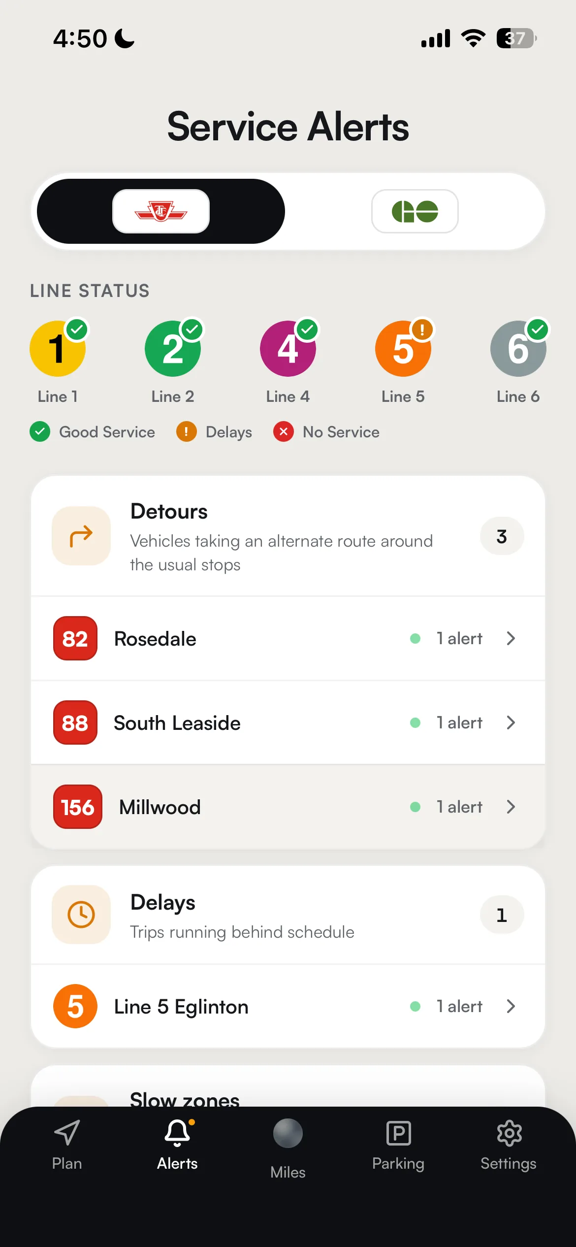
Vehicle positions on the map come from the TTC's own live feeds, refreshed every 15 seconds, so departure countdowns reflect where a train or bus actually is, not just where the schedule says it should be. No-service, delay, detour, and construction alerts are pulled from TTC's live alerts feed and sorted into one clear set of categories, with a three-state line-status board (good service, delays, no service) so you can tell a real problem from routine service noise at a glance.


Delay risk built from real TTC history
Reroute trains a model on 393,000+ real TTC delay records to score how a line's delay risk compares to a typical trip, and how severe delays tend to run once a line is already having trouble. That's a deliberate distinction: it's a relative-risk read drawn from history, not a claim about your specific trip today, and Reroute will never tell you there's an "X% chance your trip is delayed." Lines without enough logged incidents fall back to an honest neutral baseline instead of a made-up number, so an under-covered line never looks artificially safe.
Beyond the subway map
Most trips that start on the TTC don't stay on the TTC. Reroute also routes across GO Transit, UP Express, and the rest of the GTA in the same search, so a trip that starts on a streetcar and ends on a GO train shows up as one itinerary, not two separate apps. See GO Transit trip planning or every agency across Toronto transit for the wider picture.
Browse TTC lines & stations
Every TTC line and subway station has its own page: lines served, first & last train, connections, and delay risk built from real history.
Stations
- Bathurst
- Bay
- Bayview
- Bessarion
- Bloor-Yonge
- Broadview
- Castle Frank
- Cedarvale
- Chester
- Christie
- College
- Coxwell
- Davisville
- Don Mills
- Donlands
- Downsview Park
- Dufferin
- Dundas West
- Dupont
- Eglinton
- Finch
- Finch West
- Glencairn
- Greenwood
- High Park
- Highway 407
- Islington
- Jane
- Keele
- Kennedy
- King
- Kipling
- Lansdowne
- Lawrence
- Lawrence West
- Leslie
- Main Street
- Museum
- North York Centre
- Old Mill
- Osgoode
- Ossington
- Pape
- Pioneer Village
- Queen
- Queen's Park
- Rosedale
- Royal York
- Runnymede
- Sheppard West
- Sheppard-Yonge
- Sherbourne
- Spadina
- St Andrew
- St Clair
- St Clair West
- St George
- St Patrick
- Summerhill
- Tmu
- Union
- Vaughan Metropolitan Centre
- Victoria Park
- Warden
- Wellesley
- Wilson
- Woodbine
- York Mills
- York University
- Yorkdale